S.D. Horse Trails 2009 All Rights Reserved
Contact Clare Maudsley
Site by RickieDesigns
Links
HomeBarnett Ranch Preserve
Boulder Oaks
Butterfield Ranch Resort
Camp Lockett
Crestridge Reserve
Cuyamaca State Park
Daley Ranch
Eagle Rock
El Monte Trail
Fiesta Island Trail
Hollenbeck Canyon Trail
Horsethief Canyon
Laguna Mountains
Lake Hodges Trail
Lake Poway Trail
Los Penasquitos Canyon Preserve
Mission Trails
Mount Gower Preserve
Mule Hill/San Pascual Valley Trail
Oakoasis Preserve
Otay Regional Park
Pine Creek Trail
Pine Valley staging area
Ramona Grasslands Preserve
Robert's Ranch
Sacred Rocks Reserve
Santa Margarita Preserve
Santa Ysabel Preserves
Sloan Canyon Trail
StageCoach Trails
Sweetwater River Trail
Sweetwater Regional Park Trail
Sycamore Canyon Trails
Tijuana River Valley
Vern Whitaker Horse Camp
William Heise Park
---------------------
EveryTrail.com
Trail Etiquette
US Forest Services website
Info on Pacific Crest Trail
More Pacific Crest Trail info
Photos and descriptions
More photos
Has a Horse Camp
Length of Trail: Access to Pacific Crest Trail – potentially thousands of miles!
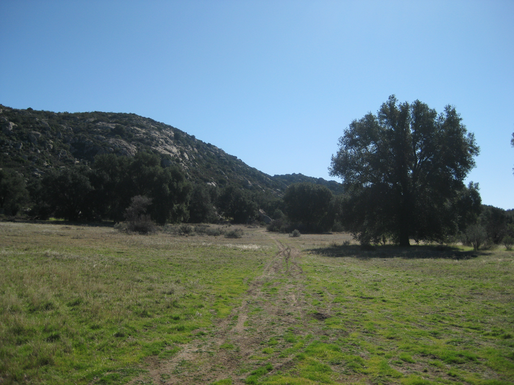
Staging Area: The staging area is located on Old Highway 80. Take the Buckman Springs Road exit from Interstate 8 East, and turn left (south) on to Old Highway 80. Boulder Oaks Campground is a mile or so down Old Highway 80 on the right (west side).
Boulder Oaks Campground is located in the Cleveland National Forest. There are 30 camping sites with 17 equestrian sites. There is day parking available. There are grills and table, but no showers or water. The equestrian sites have corrals. However, the parking spaces in the equestrian sites are tight and are bordered by short posts. There may not be enough room for your truck and trailer to drive through – be careful.
The campsite is closed March-May for Arroyo Toad breeding season. It is hot in summer, cold in winter! To make reservations, call (877) 444-6777 or reserve on line. Click for more information on the campsite.
Click here or here for current conditions, including closures and weather.
You should have an Adventure Pass to use the Cleveland national Forest.
Water: There is no water at the staging area, and only seasonal water along the trail.
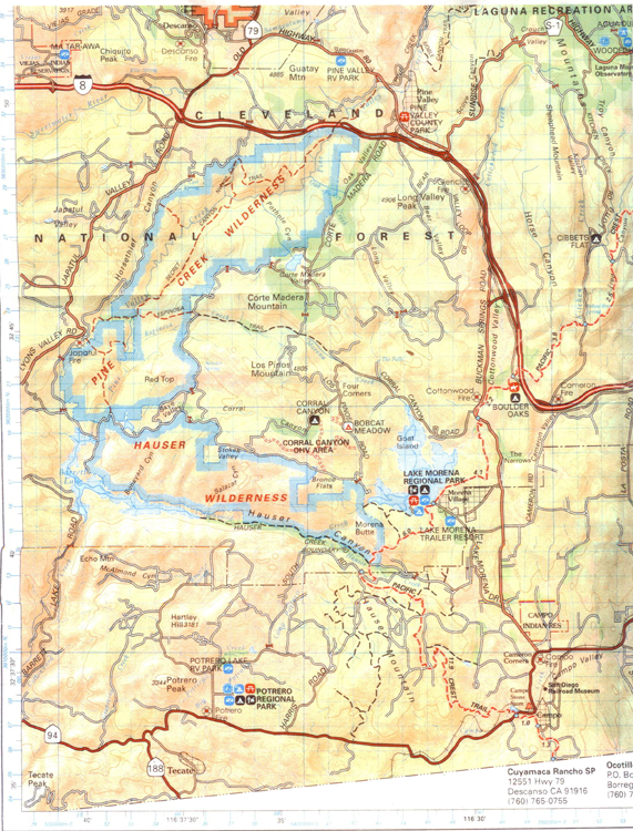
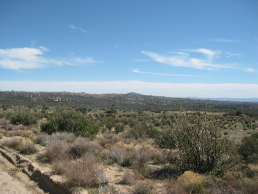
Trail Conditions: The Pacific Crest Trail is well marked. There are markers every mile or so. The trail is easy to moderate. If you travel toward Lake Morena to the south, the first 2 miles or so is flat and easy, Once you cross under Buckman Springs Road, the trail begins to climb and it is rather steep and rocky.
If you take the Pacific Crest Trail to the north, towards the Laguna Mountains, you cross Old Highway 80 and then under Interstate 8. The trail is rather steep and narrow. You pass Kitchen Creek Falls, see description below, but this is not accessible on horseback.
Description of trail to Kitchen Creek Falls.
The Pacific Crest Trail Association has good information about the Pacific Crest Trail, including a FAQ for equestrians.
You can download topo maps and trail maps from the US Forest Service.
Aerial map of PCT.
Trail Users: The trail is open to hikers, cyclists, as well as horseback riders. Dogs are also welcome.
General Trail Info: Boulder Oaks Campground is run by the US Forest Service. Its elevation is 3,300 feet.
The Pacific Crest Trail was begun in the 1930s and completed in 1993. It is a 2,650-mile national scenic trail that runs from Mexico to Canada through California, Oregon and Washington, "traversing the best scenic areas and maintaining an absolute wilderness character." Clinton C. Clark, founder. It links several existing trails: Washington's Cascade Crest Trail, Oregon's Skyline Trail, and California's John Muir and Tahoe-Yosemite Trails.
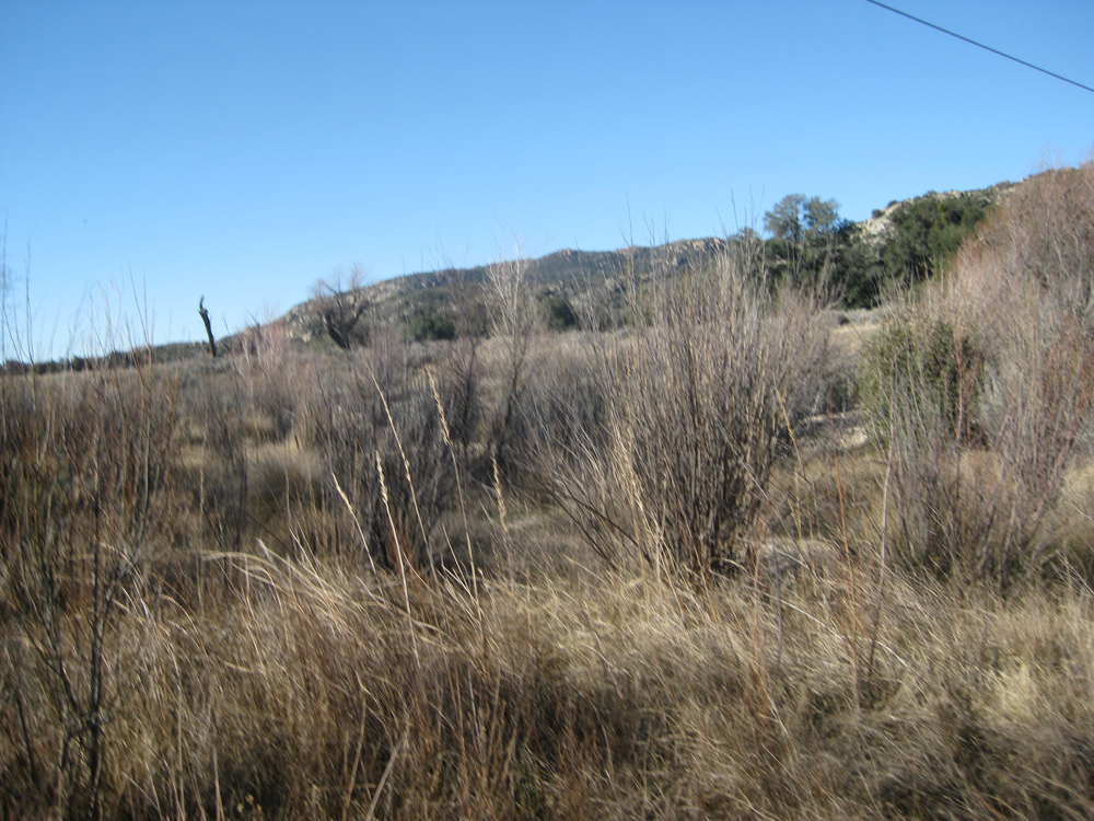
The Pacific Crest Trail passes through Lake Morena County Park and beneath Interstate 8, then climbs through chaparral, scrub oaks, and pines to the rim of the Laguna Mountains. See US Forest Service, Official Map and Guide.
 Boulder Oaks