S.D. Horse Trails 2009 All Rights Reserved
Contact Clare Maudsley
Site by RickieDesigns
Links
HomeBarnett Ranch Preserve
Boulder Oaks
Butterfield Ranch Resort
Camp Lockett
Crestridge Reserve
Cuyamaca State Park
Daley Ranch
Eagle Rock
El Monte Trail
Fiesta Island Trail
Hollenbeck Canyon Trail
Horsethief Canyon
Laguna Mountains
Lake Hodges Trail
Lake Poway Trail
Los Penasquitos Canyon Preserve
Mission Trails
Mount Gower Preserve
Mule Hill/San Pascual Valley Trail
Oakoasis Preserve
Otay Regional Park
Pine Creek Trail
Pine Valley staging area
Ramona Grasslands Preserve
Robert's Ranch
Sacred Rocks Reserve
Santa Margarita Preserve
Santa Ysabel Preserves
Sloan Canyon Trail
StageCoach Trails
Sweetwater River Trail
Sweetwater Regional Park Trail
Sycamore Canyon Trails
Tijuana River Valley
Vern Whitaker Horse Camp
William Heise Park
---------------------
EveryTrail.com
Trail Etiquette
Description of Tijuana River Valley
CA State Parks
Border State Park Info 1
Border State Park Info 2
TRVEA
YELP! Border State Park
Cool Summer Time Trails!
“Border Field State Park is on the very southwestern corner of the United States and 15 miles south of San Diego. Border Field is located within the Tijuana River National Estaurine Research Reserve, an important wildlife habitat. The sand dunes and salt marshes give refuge to critically threatened and endangered birds such as the Western Snowy Plover, the California Least Tern, and the Light-footed Clapper Rail. The park provides restrooms, picnic areas, barbecues, horse corrals, and interpretive displays. Visitors enjoy surf fishing, beach combing, hiking, horseback riding, and bird watching” CA Parks
This is the place to ride along the beach. However, this is just the beginning. There are miles of trails along the mesa by the border and through exotic undergrowth to the north of the park. Summer is the time to come. It is absolutely glorious, when it can be very hot and dry inland. In winter, however, the trails can be boggy.
Dogs are only allowed on a leash at the Monument Mesa Picnic area.
Watch out for Border Patrol agents' vehicles. Also, when the park is open, you need to drive through the Border Patrol checkpoint.
You can download a terrific trail map from The Tijuana River Valley Volunteer Association website. Check it out. Also, the TRVEA website has good information on the current status of the trails.
Directions to Tijuana River Valley:
The park is located 15 miles south of San Diego.
Latitude/Longitude: 32.5428 / -117.1214
From Interstate 5, there are 2 routes
Exit Dairy Mart Road (exit #2)
Head Southwest on Dairy Mart Road.
Dairy Mart Road will curve right onto Monument Road.
Turn right (West) on Monument Road until you reach the park entrance.
OR
(For Southbound traffic) Exit Coronado Avenue (exit #4) in Imperial Beach.
Go straight from the off-ramp onto Hollister Street.
Continue down Hollister until you reach Monument Road.
Turn right (West) on Monument Road until you reach the park entrance.
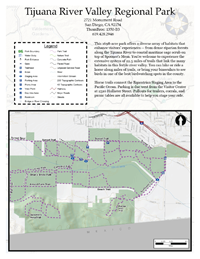
Map of Tijuana River Valley Trails.
I am going to describe the main parking areas, and some trails you can try. For a fuller description of the trails, see trvea.org. There are many more trails. If you have time, email me with your favorite trail and I will update this page.
Parking Area at Entrance to Park on Monument Road:
This is a small parking area with portapotty facilities and two corrals. There are spaces for several trailers.
From here you can ride directly west to the beach. Enjoy!!!! Watch out for the protected areas, which are marked.
Parking Area by the Beach Near the Picnic Area:
On weekends, when the park is open, you can drive your truck and trailer to the parking area by the beach, where there are bathroom facilities and several corrals. This parking area is not always open, however. Check http://www.parks.ca.gov for park opening hours.
Hollister Staging Area:
This staging area is on Hollister Street and Sunset. There is potable water, portapotties and room for about 10 trailer rigs in the staging area with overflow parking areas. There are two horse stalls, picnic tables, a hitching post and a lovely bird and butterfly garden.
From this staging area, you can get to the beach via many trails through the exotic undergrowth. For a map of the trails, see the TRVEA website. It is well worth a visit.
 Tijuana River Valley Trail/Border Field State Park


