S.D. Horse Trails 2009 All Rights Reserved
Contact Clare Maudsley
Site by RickieDesigns
Links
HomeBarnett Ranch Preserve
Boulder Oaks
Butterfield Ranch Resort
Camp Lockett
Crestridge Reserve
Cuyamaca State Park
Daley Ranch
Eagle Rock
El Monte Trail
Fiesta Island Trail
Hollenbeck Canyon Trail
Horsethief Canyon
Laguna Mountains
Lake Hodges Trail
Lake Poway Trail
Los Penasquitos Canyon Preserve
Mission Trails
Mount Gower Preserve
Mule Hill/San Pascual Valley Trail
Oakoasis Preserve
Otay Regional Park
Pine Creek Trail
Pine Valley staging area
Ramona Grasslands Preserve
Robert's Ranch
Sacred Rocks Reserve
Santa Margarita Preserve
Santa Ysabel Preserves
Sloan Canyon Trail
StageCoach Trails
Sweetwater River Trail
Sweetwater Regional Park Trail
Sycamore Canyon Trails
Tijuana River Valley
Vern Whitaker Horse Camp
William Heise Park
---------------------
EveryTrail.com
Trail Etiquette
CA Department of Fish and Game
Mountain Bike Bill trail description
Hollenbeck Canyon Article
(Honey Springs Road, Jamul Just off Campo Road/Highway 94)
Length of Trail: Main loop – 6 miles, with shortcut loops of 3 and 5 miles and extended Burnt Olive Grove Loop of 12 miles.
Staging Area: The staging area is located on Honey Springs Road, a hundred feet or so east of Highway 94 in Jamul. There is parking for 5-10 trailers. There is a Portapotty available. There are no corrals.
Water: There is no water at the staging area, but there is a water trough on the trail and several seasonal streams. For most of the year, horses have to be willing to cross water for the 6 mile loop.
Trail Conditions: Easy to moderate. Mostly wide trails – fire roads with some single track trails. The trail is well marked and easy to follow. There are a couple of rather steep long hills on the 6 mile loop.
Trail Users: The trail is open to hikers, cyclists, as well as horseback riders. Dogs are also welcome. Hunting is also permitted here in season. There is information at the trailhead about hunting seasons and at the California Department of Fish and Game website
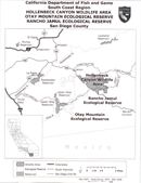
General Trail Info: Hollenbeck Canyon was part of the extensive Daley Ranch and was acquired several years ago by California Department of Fish and Game. Thanks to Supervisor Jacob and the efforts of various hunting and trail groups, this trail is now open to the public. This trail was part of the California Riding and Hiking Trail and there are current efforts to revive or reroute the trail where needed. There are a couple of CRHT markers on the trail.
The 3,200 acre wildlife area provides a wildlife corridor between Otay Mountain and Jamul mountains. Habitat includes coastal sage scrub, chaparral, oak woodlands, riparian forests, freshwater marshes and grasslands. Elevation ranges from a low of 750' to 2,100' at the highest peak.
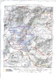
The trail is a beautiful 6 mile loop which can be extended. There are woods, streams, open land and some beautiful views in all directions. The trail is well marked and easy to follow. You travel along a fire road for at least half of the route. There are a couple of seasonal streams, which in winter can be a little tricky to get around, so your horse should be able to cross water. There are also several fairly steep hills, the steepest of which you can avoid by taking a trail to the side of it.
Cell phones generally do not work out here. However, there are spots on Honey Springs Road and Highway 94 where and along the trail where there is cell phone coverage. California Department of Fish and Game Ranger phone number: (858) 467 4210
Click here for my trail description
 Hollenbeck Canyon Trail


